Articolo disponibile anche in: Italian
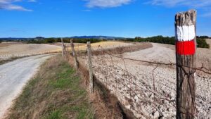
Seven hiking trails to explore the territory and appreciate the roads, places and scenery of one of the world’s most beautiful landscapes.
The Municipality of San Casciano provides a map of the trails, which is available online and accessible to everybody.
Itineraries that pass though some of the ancient Chianti routes such as the Via Romea or the Percorso del Principe (Prince’s Path) that leads from San Casciano to one of the most important historical and architectural sites of the area, the ancient hamlet of Sant’Andrea in Percussina, where Niccolò Machiavelli lived during his exile.
The itineraries of local interest, which are included in the Municipality’s urban planning, have been drafted by the same citizens, knowledgeable enthusiasts of the territory, as well as experts and environmental consultants.
The Montepaldi route, 6,5 kilometers long, arrives at the land of the Renaissance and crosses one of the most fascinating sites in Tuscany.
This is the villa, and farm, which hosts the Faculty of Agriculture of the University of Florence where its educational, research and experimental activity is carried out. In the woods of Montepaldi there is an especially beautiful ‘ragnaia’ (a small wood with nets for capturing birds), a typical feature of Italian historical gardens.
Another trail is the cycle/footpath of the Pesa (15 km) that reaches Sambuca from Montelupo, passing through Cerbaia and Fabbrica and the variante 2 of the Via Romea del Chianti. Slightly shorter is the ‘hay route’, which is 6.5 kilometres long.
The third route is the Terzona, which is over 15 kilometres long. Two other itineraries involve the Via Romea del Chianti, the first passing through San Casciano, Calzaiolo and Montefiridolfi, the second in the road link between the variante 1 and variante 2 of the Via Romea del Chianti (15 km).


