Articolo disponibile anche in:
193 km of hiking network and 277 km of cycling routes to discover the territory of Castelnuovo Berardenga on foot or on two wheels.
This is what the project for the development of infrastructures dedicated to sustainable tourism carried out by the Castelnuobo Berardenga’s municipality proposes.
With the arrangement of thematic routes enriched by special signs, information panels, maps, assistance points and web portals available to walkers and cyclists to better organize the excursion.
The project has counted on a total investment of approximately 120 thousand euros, of which 80 thousand supported by the Rural Development Program 2014-2020 of the Tuscany Region, as part of the tender for the construction of infrastructures and information for the development of sustainable tourism in rural areas. .
The hiking network and cycling itineraries, together with all the tools activated, will be presented and inaugurated on Friday 10 June with an initiative that will see the inauguration of the infrastructures at the Acqua Borra park, at 5.30 pm, and the presentation of the system of hiking and cycling itineraries, at 6 pm at the Antico Granaio di Monteaperti.
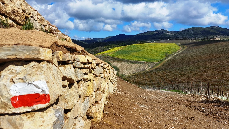
The hiking network has also allowed the creation of 13 thematic routes of different lengths identified by the signs standardized at national level by the CAI, Italian Alpine Club, and available on the Municipality’s website, www.comune.castelnuovo.si.it, in the section ” Discover the Territory “.
While on the portal www.sweetroad.it it is possible to consult the entire offer of cycling routes.
In both cases, web systems allow you to extract maps and routes in various formats and upload them to smartphones and other devices.
The project also led to the creation of a hiking map dedicated to the entire hiking network and to the detail of the thematic routes, from which it will also be possible to access an App for the real-time geolocation of the hiker.
The hiking network of Castelnuovo Berardenga is part of the REC, Chianti Classico Hiking Network, under construction by all the Municipalities of the Chianti Tourist Area – Castelnuovo Berardenga, Castellina in Chianti, Radda in Chianti, Barberino-Tavarnelle, Greve in Chianti and San Casciano – was created to enhance the vocation of sustainable tourism and gentle mobility of the Sienese and Florentine Chianti with adequate infrastructures.
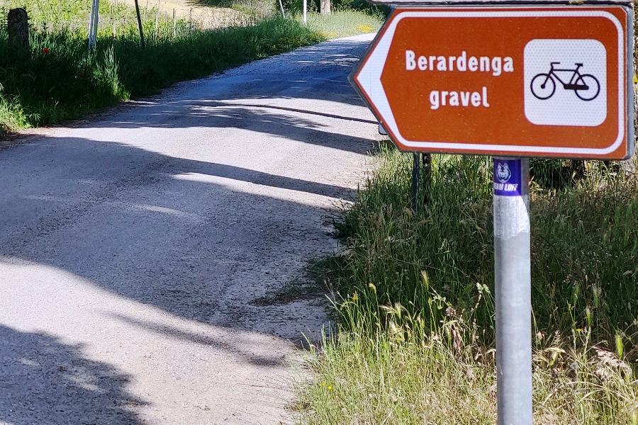
The cycling itineraries will be identified by specific signs, with two routes for road bikes – the Grand tour of Chianti and Berardenga tour, respectively of 106 and 56 km – and two routes for Gravel bikes – Berardenga Gravel and Chianti Gravel, of 58 and 57 km.
Lovers of two wheels will be able to get to know the itineraries up close on the portal www.sweetroad.it, where the accommodation facilities that have joined the project will also be available.
Furthermore, through a portal extension application, the users of the routes can be geolocated in real time.
Along the routes, first aid equipment will also be available, such as mini-workshop columns and for recharging e-bikes and bike racks.
The cycling itineraries are part of the Active Tourism District, promoted to develop bicycle mobility throughout the provincial territory and which currently counts on the membership of Castelnuovo Berardenga and other 6 Municipalities: Rapolano Terme, Asciano, Monteroni d’Arbia, Radicofani , Sinalunga and Trequanda.
Read more...